home
***
CD-ROM
|
disk
|
FTP
|
other
***
search
/
Guidemac 2
/
Guidemac 2.iso
/
Logiciels divers T1
/
Educatifs
/
Islamic History Stacks
/
Maps-Islam
/
bitmap_12586.png
< prev
next >
Portable Network Graphic
|
1994-08-22
|
5KB
|
512x342
|
1-bit (2 colors)
Labels:
text
|
map
|
diagram
OCR:
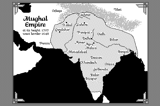
Ozbegs Tibet Mughal Kashmir Empire Kabul y Lahore at its height 1707 Qandahar' west border 1648 Panipat xy Oudhy ·Delhi Bihar. Persia Aimer agra Ahmadabad; Bengal Deccan "Khandeshi Orissa .? Golkonda: "Bidar Bijapur